Development & Investment Decision Making Strategies on Private Property II
Physical Environment Analyzing and Simulation Strategies
Another essential aspect of property investment and purchase decision-making is energy consumption and relevant architectural features. In Walt Disney Imagineering (WDI), the core and leader development department of Walt Disney Parks and Resorts, there is a sub-department called Environmental Design and Engineering (ED&E), which covers all the fields related to the sensory as well as the physical environment. Although the main responsibility for ED&E is collaborating with other departments on solid infrastructures, buildings, and architecture projects, while, in fact, they are in charge of much more than the solid world. The environmental aspect of architectural development and operation in WDI is much broader than people thought traditionally. Normally, at the developer’s point, the environmental features cover the effects brought to nature, energy, and source consumption by the project over a long-term period, and the visible exterior and interior built environment.
Without taking a field trip and investigation in person, what could a buyer know about the energy consumption history and facts of a potential property in the early stage of the transaction process without a third-party inspector’s assistant? There are various useful third-party tools and platforms applied by developers and designers for a long time, which are also meaningful for the potential homebuyers who want to get rough pictures on the target properties. The basic workflow might look like this: once the buyer has determined several potential properties information online by the real estate transaction search engine, some valuable data could be applied to the model building, such as general information model establishing, building information modeling(BIM), or any other three-dimensional visualization methods. Similar to reverse engineering widely used in military and manufacturing fields, The modeling process begins from an existing object with existing data. The modeling integrates and embodies local geography data from Geographic Information System Mapping Technology(GIS), data from the national climate database, and building enclosure performance information.
According to the Building Performance Analysis (BPA) model, architectural designers and professionals are able to learn how to incorporate high-performance building design into their workflows with digital design tools. Although BPA is designed for professionals, it is an ideal method to apply to the existing buildings’ performance analysis. Typically, the BPA model covers the design analysis and strategies on climate/weather, solar measurements, wind/airflow, daylighting, and whole-building energy optimization. (3)
Here is an incomplete list of the analysis and strategies tools for architectural programming, location/site, finance, design, construction, sale, management/operation, and reconstruction:
Revit Architecture (BIM)Environment Analysis, Modeling, and Energy Consumption simulation
Online real-time architectural/building design and simulation platforms
Sketchup Design Analysis with plugins, Modeling, and solar shading analysis, site analysis
BPA-Building Performance Analyzing for efficiency design strategies
LEED Architecture Design Strategy & Living Building Challenge
Climate Consultant, energy efficiency building design strategy
MIT Design Advisor, energy consumption simulation by room
Ecotect, architectural energy and solar studies platform
Google Earth Pro, Urban analysis, weather, natural condition, site analysis, solar analysis
Demography Analysis, data facts, demography data collection
FLUX Building Design Platform Solution
GIS analysis of the landscape, site fabric, geographic data
RSMeans Data for building construction cost calculation
Open source big data platform, geographic data information mathematic modeling analysis

Fig. Google Sunroof solar energy calculation platform makes a comparison of the property roof solar energy rate between two areas in San Francisco. Although the schedule expresses the facts on solar energy in the two districts of San Francisco, in facts, which demonstrates the hidden secrets of the total amount of solar radiation in both areas. Supported by Google Project Sunroof, https://www.google.com/get/sunroof#p=0
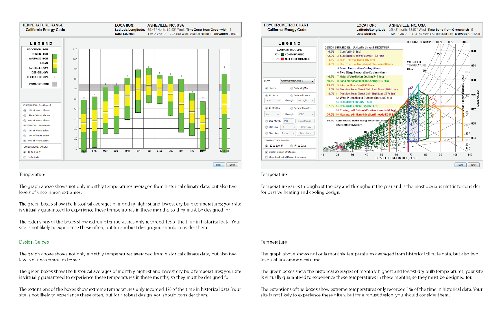
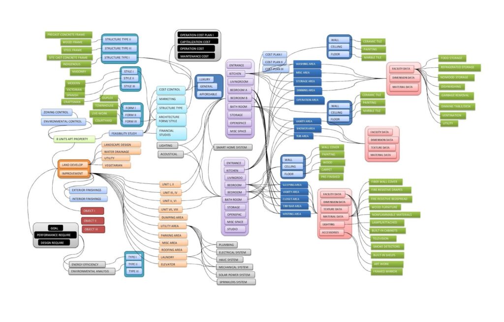
Fig. Building energy efficiency design strategies could be supplied by the third-party platform, by Climate Consultant Software, modeled by the author, system developed by UCLA
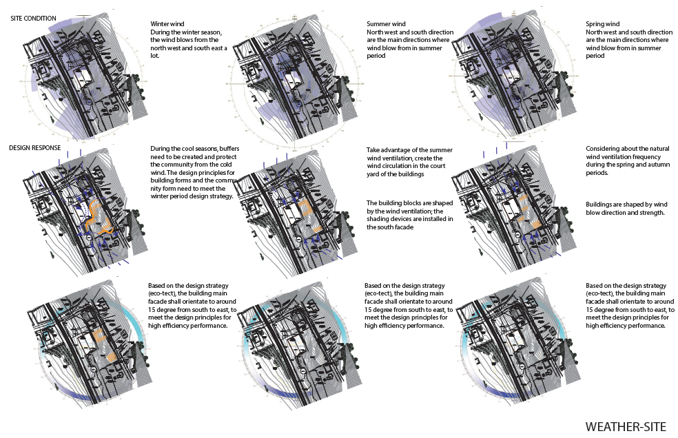
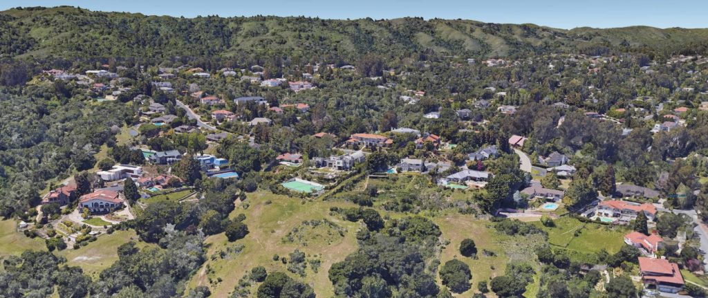
Fig. This is an example expresses the site analysis presentation, more detailed information and process are discussed in the topic of site analysis, analyzed by the author, software developed by Autodesk

Fig. building wall solar path and shading analysis, located in the Greater Los Angeles area, software supported by Autodesk, analyzed by the author
Sensory Environment Simulation Strategies
Normally, by employing professional design software and platforms, architectural designers and planners could present a simulated three-dimensional visual reality built environment to clients much easier than ever in history. Thanks to the updating technologies, many online residence interior/exterior design platforms are becoming more popular than ever, integrated with big data, cloud calculation, and VR technologies, clients are able to access, modify, re-render, and “walk around inside” anytime anywhere through the tools. Without entering into real property, the potential buyers can still “walk into the building” with a different furnishing setting. Usually, this will be helpful because the buyers may want to have an experience in the space without the furniture which they don’t like, or they can easily make the exchange the interior finishing and furnishings in the platforms.
The sensory environmental simulation strategies are normally and widely applied in the micro building elements as well as macro urban, rural or natural environment researches and evaluations through the entire life term of the design-built-operation process, which assists in the decision-makers delivering the judgments logically, adaptability and comprehensively. Thanks to the updating technologies recently, many sensory environment simulation works could be easily done by a personal computer anywhere at any time. With the aid of reverse engineering technology-a, the new methodological base for the existing architectural and environmental surveying and representation, employed by three-dimensional modeling, online data pool, and geographic data platforms, the decision-makers are able to reproduce the existing project to examine the basic facts on this product performance, the specifications of its components, costs estimating and potential patent infringement identify. For instance, a decision-maker may integrate the online data pool, GIS, inspection drawings, building technologies, and real photo images from the city planning or permit the department to reproduce the fundamental three-dimensional mass models with essential features, and evaluate and analyze the interior energy consumption facts by the building climate control simulation platforms. During the all-model reproduction process, the decision-makers no need to get to the site, or even take a field trip and survey the entire property. Taking a survey for a private is sometimes not too hard, especially the local law is not very strict, and of course, it is more valuable to take an onsite survey for the sensory environment simulation strategy.

Fig. Urban or city fabric analysis presents the necessary context data and facts for the lot or existing project, which usually examines the scale and mass of the existing urban blocks and streets. Modeled and analyzed by the author